Project Blog
Medieval Maps: the Catalan Atlas
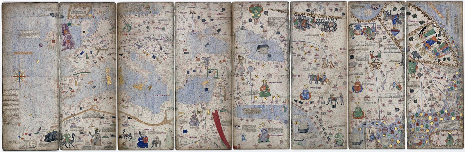
The Bibliothèque nationale de France manuscript Esp.30, better known as the ‘Catalan Atlas’ is one of the more spectacular adaptations of the Imago mundi by Honorius Augustodunensis which we study in the present project. The beautiful Atlas, attributed to one Abraham Cresques of Mallorca, was put together ca. 1375. Portions of the text that accompanies the maps and diagrams in it were translated (loosely) from the Imago mundi. The entire atlas can be browsed on the dedicated exhibition page of the Bibliothèque nationale de France.
The featured image for this post (in the banner above) is: a Montage of 8 pages (4 leaves) of the Catalan Atlas. (Public Domain. Source: Wikipedia.)
Short bibliography of the Catalan Atlas:
Clara Estow, ‘Mapping Central Europe: The Catalan Atlas and the European Imagination‘, Mediterranean Studies 13 (2004), 1-16
Piero Falchetta, ‘Manuscript No. 10057 in the Bibliotheca Marciana, Venice: A Possible Source for the Catalan Atlas?‘, Imago mundi: The International Journal for the History of Cartography 46.1 (1994), 19-28
Vicenç M. Rosselló i Verger, ‘Tides and the Catalan Atlas [1375]‘, Catalan Social Sciences Review, ISSN-e 2014-6035, Nº. 5, 2015, pp. 87-106
Post by NP